The No-Name Trail near the 10K Trailhead, and a Couple of Options
[Updated June 2025.]
The south leg of the 10K Trail crosses the Sandia Peak Ski Area well below its upper end. If you’d rather do a shorter hike and end up at the upper tram terminal, this trail will take you there. Or once at the ski area, you can drop down to the 10K trail and take that back to where you parked. I haven’t found this trail in a book or on a map; if it has an official name I don’t know what it is. The trail follows an old road bed and is well-used, so I’m surprised it isn’t published. It’s an easy, mostly shady, mostly rock-free route with modest ups and downs. For a video preview, click here.
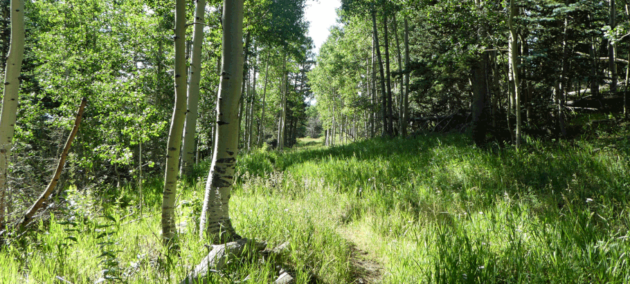
To reach the start of the trail, drive up the Crest Highway (NM 536) to the 10K Trailhead. Park across from the pit toilets, or cross the highway after parking at them. At the downhill end of the strip of parking spaces, the combined South 10K-Challenge Trail heads down into the woods. About 150 meters into the trees, the path forks. The left fork is the South 10K-Challenge Trail. The right fork is the start of what I call the No Name Trail (at 35 deg. 12.493 min. N, 106 deg. 26.050 min. W). Soon you'll find yourself on an old road bed that takes you generally southward. The trail mostly follows the road bed, though one steep section of the road has been replaced by switchbacks.
At 35 deg. 12.103 min. N, 106 deg. 25.955 min. W, you come to a fork in the trail. This is where the No Name Trail ends, at the outer point of a big hairpin turn in a mountain bike trail. Since you're not ready to turn back, I'll describe a couple of options for converting the hike into a loop. If you take the left fork, you'll be headed downhill on the King of the Mountain bike trail and eventually you'll intersect the 10K South Trail. You can take that back to the 10K Trailhead and your car. If you take the right fork, you'll be headed uphill on the bike trail and eventually you'll reach the top of the Sandia Peak Ski Area. I'll focus on the latter option here.

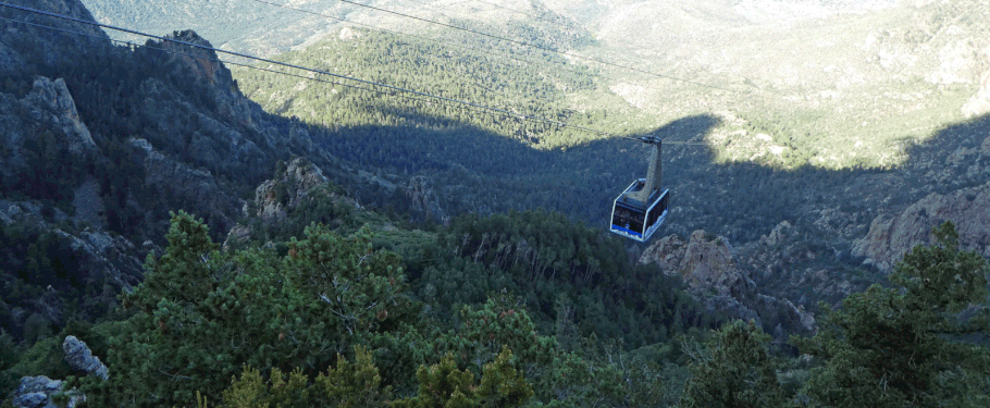
The photo shown above was taken where the right fork of the trail enters the northernmost run of the Sandia Peak Ski Area (the Double Eagle Ski Trail). Seee that second trail to the left, mere meters away? That's where you'll cross the ski run if you take the left fork at the end of the No Name Trail. Easy enough to change your mind once you're at the ski area. Anyway, this fork of the trail curls right and heads up through the ski area. At the top of the ski run is the upper tram terminal (at 35 deg. 11.738 min. N, 106 deg. 26.030 min. W) and restaurant. If you'd like to get to those sooner rather than later, you can head up the ski run instead of following the loops in the bike trail.
Once at the top of the ski area, you have multiple options for loop hikes. You can take one of several trails that trend northward along the crest of the Sandias, then use other trails (including the Challenge Trail) to get back to your car. Or you can take the Crest Trail south to the south end of the 10K Trail and follow that northward—since the trailhead is where you parked. Or just retrace your steps down the ski run and back along the No Name Trail. As a guess, this last option is 1 1/4 miles each way.
Notes:
Previously, the start of the No Name Trail was accessed by following the downhill edge of the meadow extending south from the 10K trailhead, then turning left onto the old road. That part of the route has now been blocked off with tangles of branches. Clearly, the Forest Service wants people to access the No Name Trail via the 10K South-Challenge Trail, as I describe above.
The trail work done along the No Name Trail suggests that one of these days, the trail may get an official name and number. I know that back in 2019, the Forest Service was considering doing that. But as of this writing (2025), it hasn't happened yet.
